16. Holmfjellet/Suolovárri, Gulbojok

Enkel


Turbeskrivelse
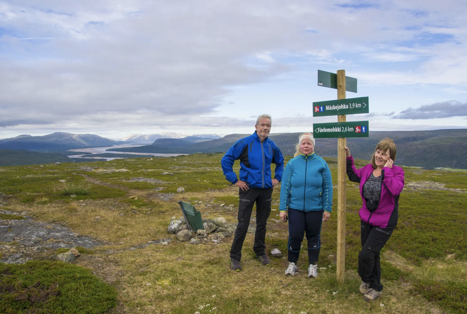
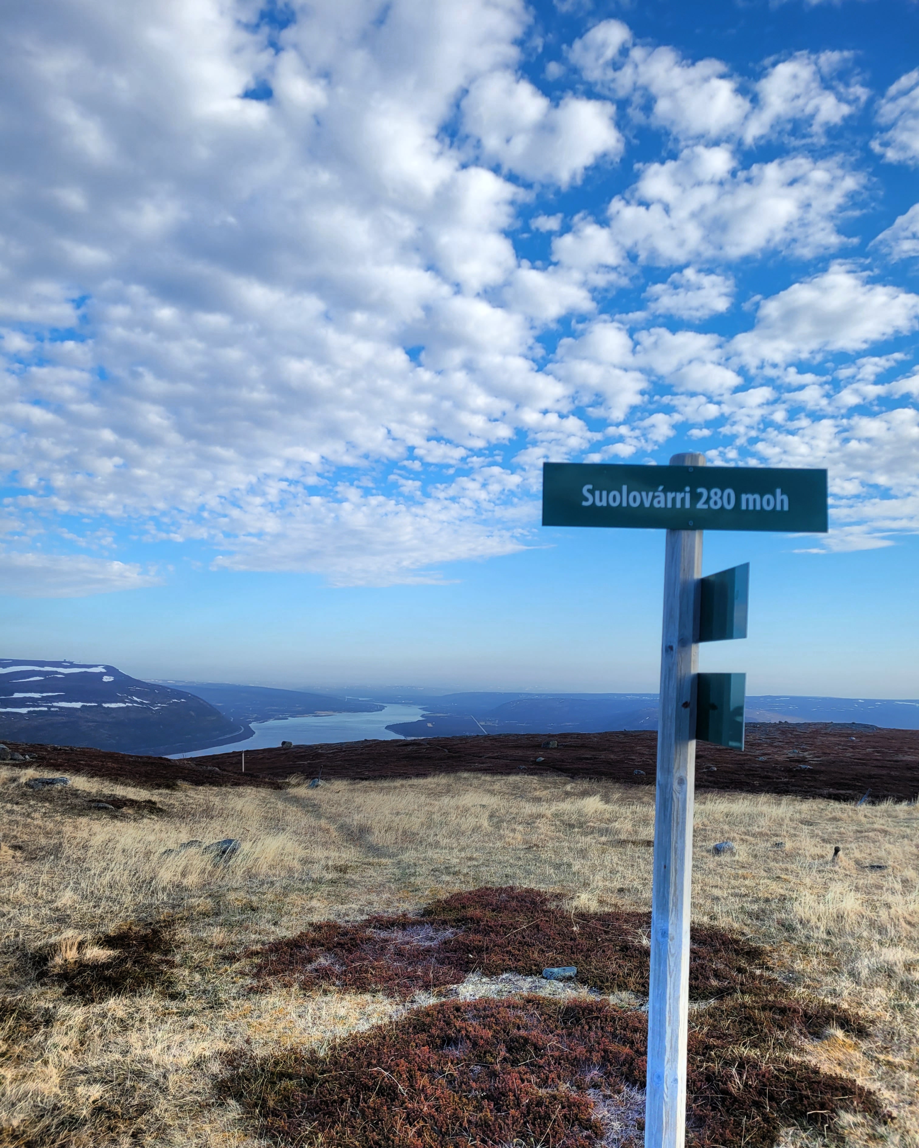
Fin og lett fottur til toppen av Holmfjellet - Suolovárri (280moh). Underveis er det fin utsikt mot munningen av Tanaelva. Fra toppen av fjellet er det flott utsikt i alle retninger.
Fin turløype som er en Perletur i Tana kommune, med en merket og god sti i greit terreng. Det er 2,8 kilometer å gå til toppen og det er tørt og fint å gå. Holmfjell og Gulbojok bygdelag har ryddet og merket turløypa med rød maling på trær og steiner. Det er også skilt underveis som angir retning til toppen. Det er en turkasse for å skrive navnet sitt i på toppen av fjellet. Samme trase brukes også som terrengsykkelløype.
NB! Husk båndtvang da det er sauer på beite i området.
Kontaktperson
46400269
Løype på kart
Flest besøk 2026
| Navn | Besøk |
|---|---|
| Målfrid Kitti | 2 |
| Solfrid Iversen | 1 |
| Henriette Hardy | 1 |
| Ingrid Smuk Rolstad | 1 |
| Shiela Marie Ringstad | 1 |
| Ragnhild Holberg | 1 |
| Jørn Kollstrøm | 1 |
| Trine Sveinsdatter Johansen | 1 |
| Madelen Dervola | 1 |
| Grethe Elise Pettersen | 1 |
Besøkslogg
| Dato | Antall besøk |
|---|---|
| 18. jun | 2 |
| 16. jun | 1 |
| 14. jun | 2 |
| 12. jun | 1 |
| 11. jun | 2 |
| 10. jun | 1 |
| 09. jun | 1 |
| 07. jun | 3 |
| 06. jun | 4 |
| 03. jun | 7 |
Turbeskrivelse på andre språk
English
A nice and easy hike to the top of Holmfjellet - Suolovárri (280 meters above sea level). Along the way, there are beautiful views of the mouth of the Tana River. From the top of the mountain, there are great views in all directions.
A beautiful hiking trail that is a Perletur in the municipality of Tana, with a marked and well-maintained path in easy terrain. It is 2.8 kilometers to the top, and the terrain is dry and easy to walk on. Holmfjell and Gulbojok village communities have cleared and marked the trail with red paint on trees and rocks. There are also signs along the way indicating the direction to the summit. There is a box at the top of the mountain where you can write your name. The same route is also used as a mountain bike trail.
NB! Remember to keep your dog on a leash as there are sheep grazing in the area.
Русский
Легкая и приятная пешая прогулка на вершину Хольмфьеллет — Суоловарри (280 м над уровнем моря). По пути открывается прекрасный вид на устье реки Тана. С вершины горы открывается великолепный вид во всех направлениях.
Прекрасная туристическая тропа, которая является частью маршрута Perletur в муниципалитете Тана, с хорошо обозначенной тропой на ровной местности. До вершины 2,8 км, тропа сухая и удобная для ходьбы. Holmfjell и Gulbojok bygdelag расчистили и обозначили туристическую тропу красной краской на деревьях и камнях. По пути также установлены указатели, указывающие направление к вершине. На вершине горы есть ящик, в который можно вписать свое имя. Тот же маршрут используется и как трасса для велосипедов.
NB! Помните, что в этом районе пасутся овцы, поэтому собаки должны быть на поводке.